
Severe, damaging thunderstorms targeted parts of the Southeast on Saturday, with more severe weather possible on Sunday.
Several homes were damaged due to fallen trees in Rogersville, Tennessee and the community of Persia, Tennessee, and injuries were reported. In North Carolina, Fayetteville Airport reported a 72 mph wind gust from thunderstorms.
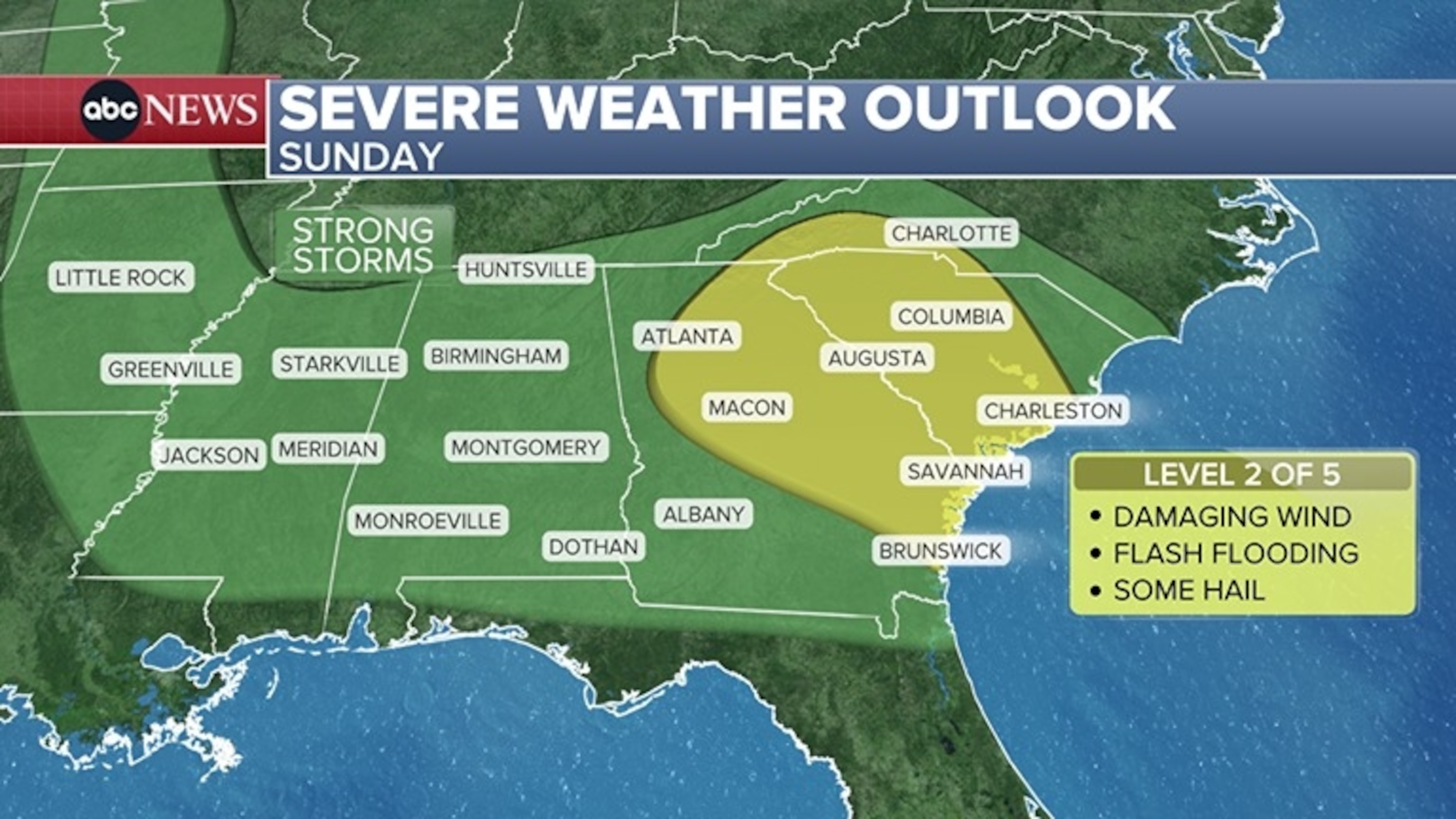
On Sunday, a level 2 out of 5 “slight risk” for severe weather is in effect for parts of Georgia, North Carolina and South Carolina, including Atlanta, Savannah, Columbia, Charleston and Charlotte.
Damaging winds and flash flooding are the main threats, but some hail is also possible.
The same “slight risk” for severe weather exists Sunday in parts of Montana, including Great Falls and Butte. Damaging winds and large hail are the main threats with storms later today in the area.
While portions of the Southeast faced severe weather for the first part of the holiday weekend, it’s important to note that overall, much of the country is experiencing quiet conditions weather-wise for the Labor Day holiday weekend.
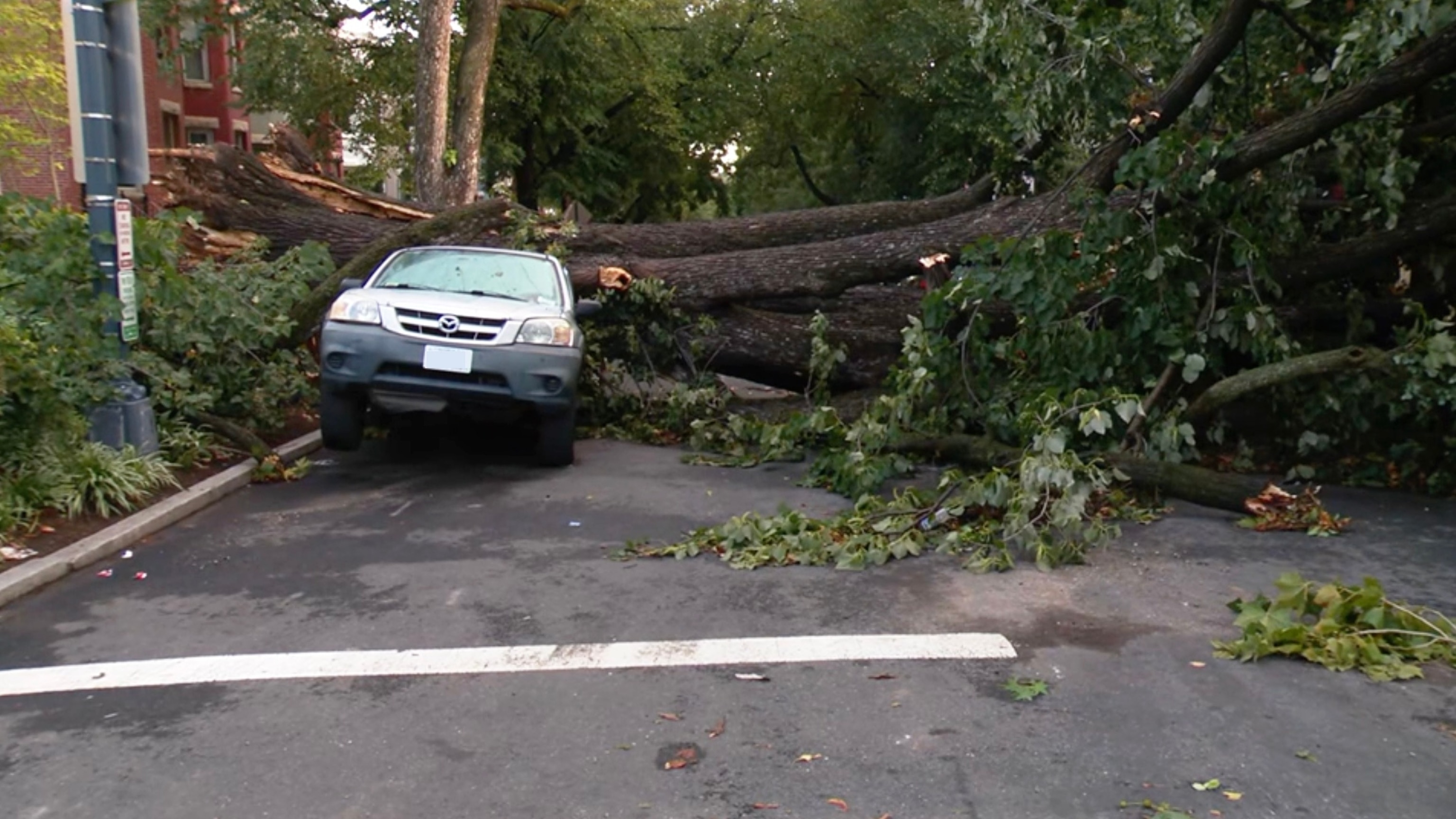
In this screen grab from a video, a car is damaged after a large tree fell on it during a severe storm that ripped through the area, on Sept. 4, 2026.
WJLA
For the Labor Day holiday on Monday, there is no organized severe weather threat as much of the country continues to enjoy rather tranquil weather. Some areas could still see scattered thunderstorms which could bring lightning, gusty winds and downpours in spots.
Triple-digit heat scorches the Southeast
Dangerous heat persists for millions as the holiday weekend continues, with more than 40 million Americans under heat alerts Sunday from Kansas to Georgia.
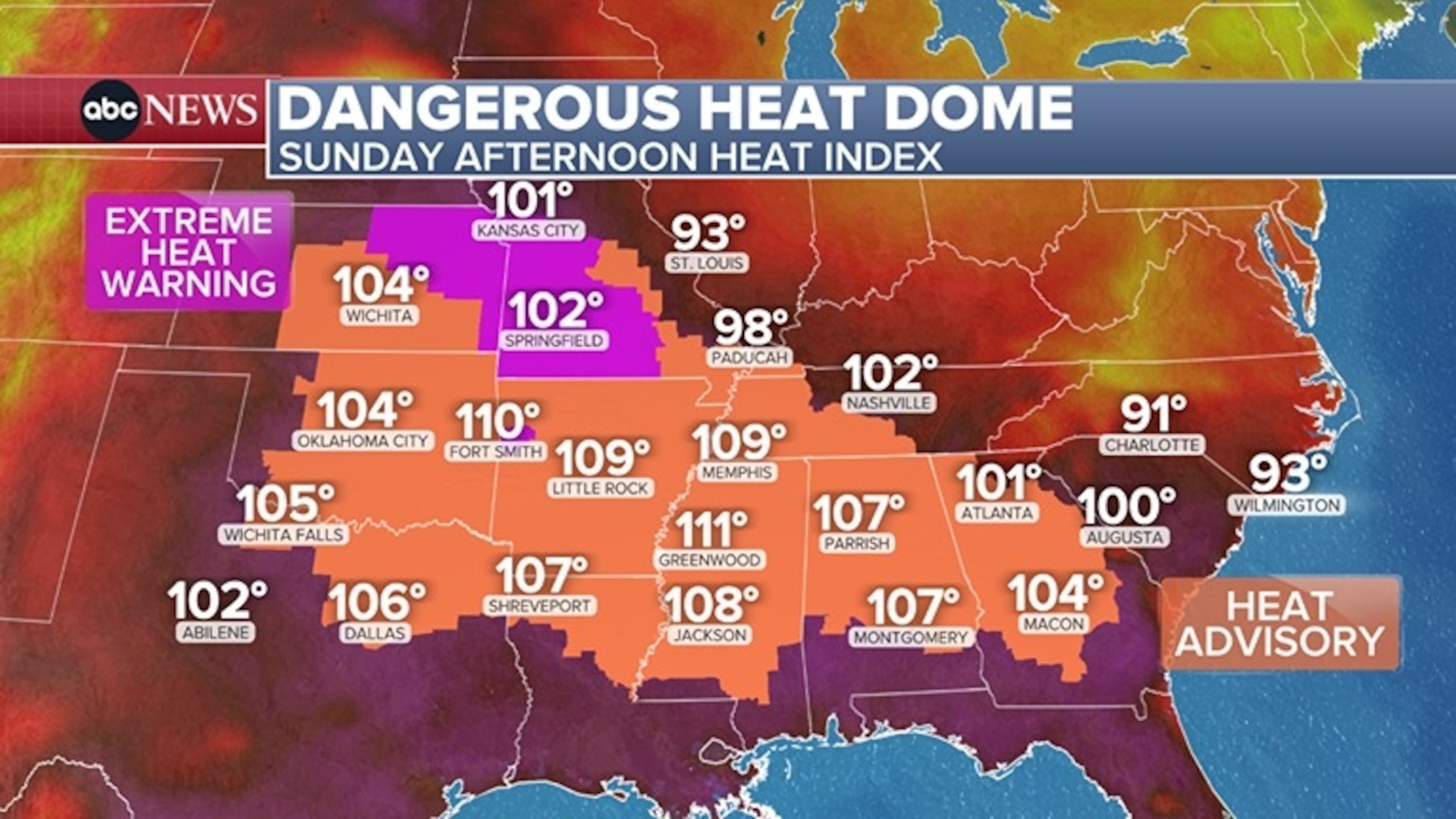
Heat indices are soaring into the triple digits across this large swath of the country later Sunday afternoon.
Cooler and more comfortable conditions continue to settle in for much of the Northeast and will do the same farther south along much of the East Coast later Sunday.
Afternoon high temperatures will be in the mid-80s in Washington, D.C., Sunday and in the 70s in New York City Sunday and on Monday.
Raleigh, North Carolina will see highs decrease to the mid-80s Sunday after a long stretch of brutal heat.
However, parts of the Plains and South will remain very hot through the new workweek. An Extreme Heat Warning remains in place for Kansas City through Tuesday. Highs will be in the mid-90s each day, with feels-like temperatures up to 105 degrees during the afternoon.
Flash flood threat
On Sunday, the potential for flash flooding returns to parts of the Southwest, with a level 2 of 4 risk over parts of southern Nevada, northern Arizona and Utah.
This includes many national parks in Arizona and Utah on Sunday, including Grand Canyon National Park, Zion National Park and Bryce Canyon National Park, all which recently experienced significant flash flooding impacts from monsoon storms.
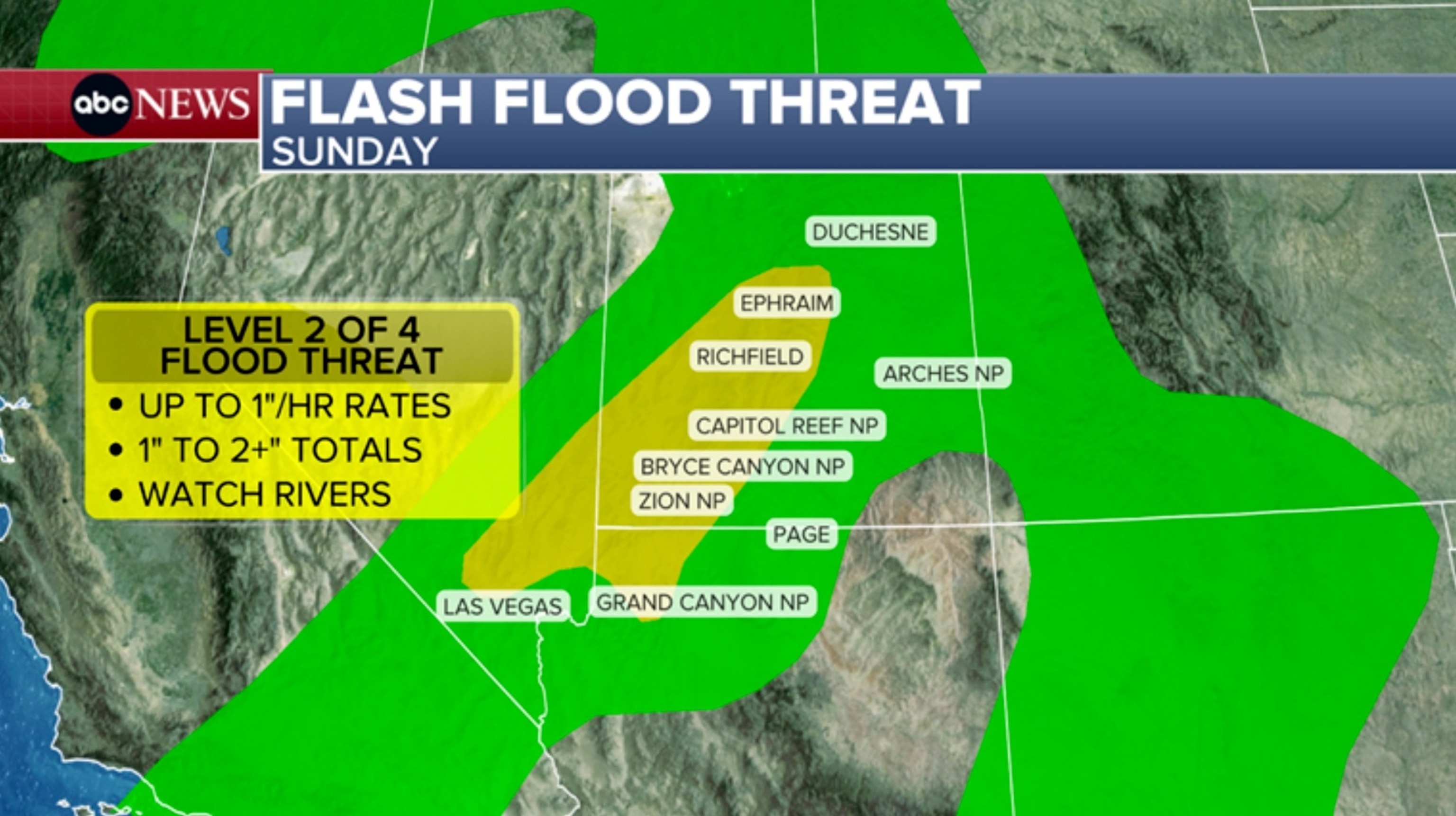
A Flood Watch has been posted for Sunday across portions of Utah, including Cedar City, Beaver Richfield and Price, as well as Zion National Park and Bryce Canyon National Park.
While the threat is not as widespread and intense as the previous event, scattered thunderstorms later in the day could bring downpours and frequent lightning. Flash flooding is possible where the heaviest rain develops.
Any burn scar areas from recent wildfires in Utah and Arizona will be especially vulnerable to any heavy rain that falls on Sunday.
Tropical storm warning issued for parts of Hawaii
Hurricane Lowell and Tropical Storm Karina will bring high surf impacts to the Hawaiian Islands through the holiday weekend, while Lowell is expected to bring heavy rain to Hawaii.
The National Weather Service issued a tropical storm warning for Kauai County on Sunday, saying tropical storm conditions were expected for Kauai Northwest Waters, Kauai Windward Waters, Kauai Leeward Waters and Kauai Channel on Monday morning and lasting through Tuesday afternoon.
Lowell has weakened slightly back to a Category 3 hurricane, with maximum sustained winds of 125 mph. It’s moving to the north-northwest at 6 mph with the center currently located roughly 600 miles southwest of Honolulu.Â
Lowell is forecast to remain a major hurricane over the next 24 hours but a weakening trend is expected to take over as it continues its turn to the north. The tropical system is still forecast to pass west of the main Hawaiian Islands late Monday into Tuesday.
Lowell is already bringing high surf to the south- and southeast-facing shores of the islands. A High Surf Advisory in effect for waves up to 12 feet along these shorelines.
While landfall is not expected, some of the outer bands of Lowell could impact the western Hawaiian Islands early this week.